Price Reduced10
$195,500
3 bd · 2 ba · 1,254 sqft
1575 Winston Ave, Baltimore, MD

Est. $1,316/mo$164/sqft · 315 days on Realty
3
Beds
1
Baths
1,140
Sqft
1948
Built
This charming 3-bedroom townhouse is located on a quiet street, making it perfect for first-time homebuyers or those looking to downsize. With its prime location and spacious interior, it's a great chance to own a piece of paradise. Don't miss out - schedule a viewing today and make this house your home sweet home!
Listing agent
Donald Paul Odoms
Courtesy of Maryland Real Estate Center LLC
(443) 413-9000

Bright MLS · Listing MDBA2195318
$37,400
Estimated monthly payment
$1,316/mo
Loan amount $149,600. Estimate only — your actual rate and payment depend on credit, location, and lender.
2025 roll
School ratings (A+ to F) from HJN community data.
Yorkwood Elementary School
PK-5 · Regular · Baltimore City Public Schools
294 students · 14.3:1 student–teacher
Garrett Heights Elementary/Middle School
PK-8 · Regular · Baltimore City Public Schools
320 students · 12.3:1 student–teacher
Cardinal Shehan School
PK-8 · Regular
319 students · 16.1:1 student–teacher
Reginald F. Lewis High School
9-12 · Regular · Baltimore City Public Schools
481 students · 16.0:1 student–teacher
Achievement Academy at Harbor City High School
9-12 · Alternative/Other · Baltimore City Public Schools
314 students · 17.9:1 student–teacher
Northwood Elementary School
PK-5 · Regular · Baltimore City Public Schools
641 students · 17.1:1 student–teacher
Mercy High School
9-12 · Regular
446 students · 9.8:1 student–teacher
The Children's Guild
1-11 · Special Education
133 students · 5.8:1 student–teacher
This content last refreshed on 2026-10-26 13:41:03 UTC. Some properties which appear for sale on this web site may subsequently have sold or may no longer be available.
Tawonna Melton · United Real Estate Executives
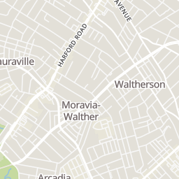
Bright MLSRings at ½ mile and 1 mile. Basemap © OpenMapTiles © OpenStreetMap contributors.
Open the Baltimore camera map1 speed camera mapped within ½ mile of this home. Nearest: 0.1 mi southeast.
| Device type | Within ½ mi | Within 1 mi |
|---|---|---|
| License-plate readers | 0 | 5 |
| Gunshot detectors | 0 | 1 |
| Speed cameras | 1 | 3 |
Community-reported via OpenStreetMap; may be incomplete. Data as of . © OpenStreetMap contributors (ODbL)
License-plate readers (ALPR) are fixed cameras that photograph passing vehicles and read their plates. Records are typically shared with the agency or association that operates the camera.
Gunshot detectors are acoustic sensors that listen for gunfire and report its estimated location.
Speed cameras photograph vehicles over the speed limit for automated tickets.
Within 2 miles of this home: 38+ restaurants and cafés, 9 grocery stores, 30 parks and green spaces, and 40+ transit stops.
Place data from OpenStreetMap.
Papa John's
Harford Road
Batch Bake Shop
Harford Road
Char'd CIty
Harford Road
Pizza Bravo Plus
Harford Road
Emma's Tea Spot
Harford Road
Los Rancheros
Mexican restaurant · Harford Road
Brannan's Pub
Harford Road
Lost In The 50's
American restaurant · Harford Road
Royalty Food International Supermarket
Shoppers Food & Pharmacy
Safeway
Harford Road
ShopRite
Cleanleigh Drive
Lidl
Havenwood Road
Belvedere Square Market
Asia Food
York Road
Govanstowne Farmers' Market
York Road
Mount Pleasant Park
Woodbourne Avenue Park
Woodbourne Avenue
Yorkwood Elementary School Playground
Chinquapin Run Park
Pentwood Park
Mt. Pleasant Woods
North Harford Park
Hamlet Avenue
Idlewood Park
Falkirk Road
Belvedere Avenue & Perring Parkway Eastbound
Belvedere Avenue & Willowton Avenue Westbound
Belvedere Avenue & Willowton Road Eastbound
Echodale Avenue & Perring Parkway Westbound
Belvedere Avenue & Beechdale Avenue Westbound
Echodale Avenue & Herring Run Drive Eastbound
Echodale Avenue & Herring Run Drive Westbound
Belvedere Avenue & Hillen Road Far-side Eastbound