
 27

$199,900
3 bd · 1 ba · 1,080 sqft
3200 Offutt Rd, Randallstown, MD
Mario Caruso · Taylor Properties


No listing photos
—
Beds
2.5
Baths
2,020
Sqft
1930
Year built
Range $170,032 – $192,688 · as of August 30, 2026
ATTOM automated valuation model · 54 published estimates over 6.7 years · shaded band is the model's own published low-to-high range
Highest reading $390,622 in April 2026; lowest $170,000 in January 2026. The vertical scale starts at the series' own low, not at zero — it is drawn to show movement, not absolute size.
$36,272
Estimated monthly payment
$1,280/mo
Loan amount $145,088. Estimate only — your actual rate and payment depend on credit, location, and lender.
2025 roll
School ratings (A+ to F) from HJN community data.
Randallstown Elementary School
KG-5 · Regular · Baltimore County Public Schools
322 students · 16.0:1 student–teacher
Church Lane Elementary Technology School
PK-5 · Regular · Baltimore County Public Schools
273 students · 13.7:1 student–teacher
Windsor Mill Middle School
6-8 · Regular · Baltimore County Public Schools
606 students · 17.3:1 student–teacher
Randallstown High School
9-12 · Regular · Baltimore County Public Schools
1,091 students · 16.4:1 student–teacher
Winfield Elementary School
PK-5 · Regular · Baltimore County Public Schools
447 students · 13.8:1 student–teacher
Winand Elementary School
EE-5 · Regular · Baltimore County Public Schools
426 students · 13.6:1 student–teacher
Scotts Branch Elementary School
KG-5 · Regular · Baltimore County Public Schools
457 students · 16.4:1 student–teacher
Windsor Christian Academy
PK-KG · Early Childhood Program/Child Care Center
7 students · 7.0:1 student–teacher
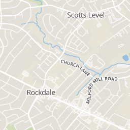
Rings at ½ mile and 1 mile. Basemap © OpenMapTiles © OpenStreetMap contributors.
Open the Randallstown camera map2 license-plate readers mapped within ½ mile of this home, both identified as Flock Safety devices. Nearest: 0.4 mi southeast. Operator named in the data: The Home Depot.
| Device type | Within ½ mi | Within 1 mi |
|---|---|---|
| License-plate readers | 2 | 3 |
| of which Flock Safety | 2 | 3 |
Community-reported via OpenStreetMap; may be incomplete. Data as of . © OpenStreetMap contributors (ODbL)
License-plate readers (ALPR) are fixed cameras that photograph passing vehicles and read their plates. Records are typically shared with the agency or association that operates the camera.
Flock Safety is a company whose plate-reader cameras are used by police departments, cities, HOAs and businesses. Its devices are usually solar-powered and pole-mounted.
Within 2 miles of this home: 16 restaurants and cafés, 3 grocery stores, 17 parks and green spaces, and 39+ transit stops.
Place data from OpenStreetMap.
Papa John's
Liberty Road
Domino's
Brenbrook Drive
KFC
Liberty Road
Chick' N Trout
Tom's Sports Tavern
Liberty Road
Checkers
Dunkin
Old Court Road
Popeyes
Liberty Road
Walmart Supercenter
Liberty Road
ALDI
Liberty Road
Food Lion
Liberty Road
Stoneybrook North Local Open Space
Scotts Level Park
Carriage Hills Park
Marriottsville Road
Stevenswood Park
Carriage Hills Park Playground
Marriottsville Road
Stevenswood Park Playground
Glen Michael Lane
Marriottsville Road Extension
Mardella Ridge Forest Buffer Forest Conservation Reservation
Liberty Road & Fieldstone Road Northbound
Liberty Road & Fieldstone Road Opposite Southbound
Liberty Road & Stoneybrook Road Southbound
Liberty Road & Stoneybrook Road Northbound
Liberty Road & Marcella Avenue Opposite Northbound
Liberty Road & Bayer Avenue Far-side Southbound
Liberty Road & Offutt Road Northbound
Liberty Road & Anne Hathaway Drive Far-side Northbound
Bright MLSSome properties which appear for sale on this web site may subsequently have sold or may no longer be available.