46

$460,000
4 bd · 2 ba · 3,741 sqft
12 Sundew Rd, Newark, DE
Charles C Hultberg Jr. · Long & Foster Real Estate, Inc.

No listing photos
4
Beds
1.5
Baths
1,716
Sqft
1948
Year built
Range $405,301 – $466,159 · as of October 21, 2026
ATTOM automated valuation model · 54 published estimates over 6.8 years · shaded band is the model's own published low-to-high range
Highest reading $537,000 in April 2026; lowest $252,750 in April 2020. The vertical scale starts at the series' own low, not at zero — it is drawn to show movement, not absolute size.
$87,146
Estimated monthly payment
$2,901/mo
Loan amount $348,584. Estimate only — your actual rate and payment depend on credit, location, and lender.
2025 roll
Bright MLSSome properties which appear for sale on this web site may subsequently have sold or may no longer be available.
46$460,000
4 bd · 2 ba · 3,741 sqft
12 Sundew Rd, Newark, DE
Charles C Hultberg Jr. · Long & Foster Real Estate, Inc.
 Price Reduced36
$369,900
4 bd · 2 ba · 1,425 sqft
345 Tamara Cir, Newark, DE
Diane Salvatore · Patterson-Schwartz-Hockessin
 Price Reduced24
$350,000
3 bd · 2 ba · 1,725 sqft
911 Pheasant Run, Newark, DE
Patrick W Haydt · Compass
 25
$360,000
3 bd · 3 ba · 1,913 sqft
59 Helios Ct, Newark, DE
Kathleen A Pigliacampi · Patterson-Schwartz-Hockessin
 Price Reduced51
$374,999
4 bd · 3 ba · 1,700 sqft
21 Cordele Rd, Newark, DE
Justin Charles Weeks · Long & Foster Real Estate, Inc.
 25
$389,900
4 bd · 3 ba · 1,875 sqft
1 Winnwood Rd, Newark, DE
Earl Endrich · BHHS Fox & Roach - Hockessin
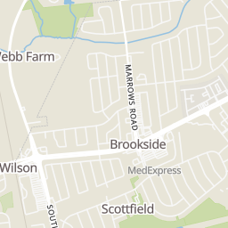
Rings at ½ mile and 1 mile. Basemap © OpenMapTiles © OpenStreetMap contributors.
Open the Newark camera map9 devices mapped within ½ mile of this home: 7 license-plate readers, 1 CCTV camera, and 1 speed camera; 6 of them identified as Flock Safety devices. Nearest: 0.2 mi north. Operator named in the data: Newark Police Department.
| Device type | Within ½ mi | Within 1 mi |
|---|---|---|
| License-plate readers | 7 | 11 |
| of which Flock Safety | 6 | 9 |
| CCTV cameras | 1 | 1 |
| Speed cameras | 1 | 1 |
Community-reported via OpenStreetMap; may be incomplete. Data as of . © OpenStreetMap contributors (ODbL)
License-plate readers (ALPR) are fixed cameras that photograph passing vehicles and read their plates. Records are typically shared with the agency or association that operates the camera.
Flock Safety is a company whose plate-reader cameras are used by police departments, cities, HOAs and businesses. Its devices are usually solar-powered and pole-mounted.
CCTV cameras are fixed video cameras that record a street, building or other area.
Speed cameras photograph vehicles over the speed limit for automated tickets.
School ratings (A+ to F) from HJN community data.
Newark Center for Creative Learning
KG-8 · Special Program Emphasis
77 students · 7.4:1 student–teacher
West Park Place Elementary School
KG-5 · Regular · Christina School District
350 students · 13.0:1 student–teacher
Newark High School
9-12 · Regular · Christina School District
1,039 students · 15.3:1 student–teacher
Within 2 miles of this home: 40+ restaurants and cafés, 6 grocery stores, 39+ parks and green spaces, and 4 transit stops.
Place data from OpenStreetMap.
Library Commons: The Nest
Bing's Bake & Brew
South Main Street
Little Teriyaki
South Main Street
Tiger Sugar
South Main Street
Buffalo Wild Wings
South Main Street
OVERBAKED Bakery Cafe
South Main Street
Claymont Steak Shop
South Main Street
Pat's Pizza Family Restaurant and MVP Sports Bar
South Main Street
Mi Ranchito
Mexican restaurant · North Chapel Street
Newark Natural Foods
Newark Shopping Center
Wang's Oriental Food Store
East Main Street
Acme
College Square
Food Lion
ShopRite
Chestnut Hill Plaza
Lewis Park
Hillside Park
Kells Park
Phillips Park
Worrilow Garden
Clark Garden
Edna C. Dickey Park
Trial Garden
Newark
Flixbus
Newark Transit Hub
University of Delaware Parking Lot #6 on Christiana Dr