99
$1,795,000
4 bd · 4 ba · 3,448 sqft
1109 Sterling Ave, Berkeley, CA
Theresa Hope Broderick · The Agency · on 4 MLSs


No listing photos
4
Beds
4
Baths
2,549
Sqft
1937
Year built
Range $1,973,449 – $3,029,947 · as of August 30, 2026
ATTOM automated valuation model · 54 published estimates over 6.7 years · shaded band is the model's own published low-to-high range
Highest reading $2,516,922 in July 2026; lowest $588,900 in September 2025. The vertical scale starts at the series' own low, not at zero — it is drawn to show movement, not absolute size.
$500,340
Estimated monthly payment
$16,158/mo
Loan amount $2,001,358. Estimate only — your actual rate and payment depend on credit, location, and lender.
2026 roll
Some properties which appear for sale on this web site may subsequently have sold or may no longer be available.
School ratings (A+ to F) from HJN community data.
Cragmont Elementary School
KG-5 · Regular · Berkeley Unified School District
290 students · 21.5:1 student–teacher
Thousand Oaks Elementary School
KG-5 · Regular · Berkeley Unified School District
337 students · 21.1:1 student–teacher
School of the Madeleine
KG-8 · Regular
262 students · 7.6:1 student–teacher
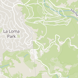
Rings at ½ mile and 1 mile. Basemap © OpenMapTiles © OpenStreetMap contributors.
Open the Berkeley camera map1 license-plate reader mapped within ½ mile of this home, identified as a Flock Safety device. Nearest: 0.1 mi south. Operator named in the data: Berkeley Police Department.
| Device type | Within ½ mi | Within 1 mi |
|---|---|---|
| License-plate readers | 1 | 10 |
| of which Flock Safety | 1 | 10 |
Community-reported via OpenStreetMap; may be incomplete. Data as of . © OpenStreetMap contributors (ODbL)
License-plate readers (ALPR) are fixed cameras that photograph passing vehicles and read their plates. Records are typically shared with the agency or association that operates the camera.
Flock Safety is a company whose plate-reader cameras are used by police departments, cities, HOAs and businesses. Its devices are usually solar-powered and pole-mounted.
Within 2 miles of this home: 39+ restaurants and cafés, 10 grocery stores, 39+ parks and green spaces, and 11+ transit stops.
Place data from OpenStreetMap.
Raxakoul Coffee & Cheese
Inn Kensington
Arlington Avenue
Jerusalem Organic Kitchen
Solano Avenue
Bangalore Blues
Solano Avenue
Tha Siam Thai Bistro
Thai restaurant · Solano Avenue
Ajanta
Indian restaurant · Solano Avenue
Noah's Bagels
Solano Avenue
Cactus Taqueria
Mexican restaurant · Solano Avenue
Young's Market
Andronico's Community Market
Solano Avenue
North Berkeley Farmer's Market
Safeway
Shattuck Avenue
Colusa Market
Colusa Avenue
Kensington Farmer's Market
Andronico's
Shattuck Avenue
Monterey Market
Hopkins Street
Zaytuna College Permaculture Garden
Cragmont Park
Regal Road
Remillard Park
Poppy Lane
Dorothy Bolte Park
Spruce Street
Grotto Rock Park
Santa Barbara Road
Crescent Park
John Hinkel Park
Somerset Avenue
Mortar Rock Park
Indian Rock Avenue
Grizzly Peak Boulevard & Sunset Lane
Grizzly Peak Boulevard & Marin Avenue
Grizzly Peak Boulevard & Forest Lane
Grizzly Peak Boulevard & Keeler Avenue
Euclid Avenue & Rock Walk
Euclid Avenue & Poplar Street
Euclid Avenue & Marin Avenue
Grizzly Peak Boulevard & Creston Road (Northwest Junction)