Price Reduced47

$1,299,000
3 bd · 3 ba · 2,646 sqft
2991 Yolanda Ave, Springfield, OR
Kit Sixel · Sixel Real Estate
$84/sqft · 285 days on Realty
13,090
Building
6,534 sqft
Lot
1954
Built
Main Street redevelopment opportunity. 13,090 sf building with tall ceilings and exposed wood beams. Mixed use commercial zoning allows for most residential and commercials uses. High visibility location next door to Wildish Theater and City Hall. Recently appraised and priced below appraise value.
Listing agent
Kristena Cox
Courtesy of Windermere RE Lane County
(541) 501-3399
Regional Multiple Listing Service (RMLS) · Listing 713622761
2026 roll
Regional Multiple Listing Service (RMLS)This content last refreshed on 2026-11-17 10:22:27 UTC. Some properties which appear for sale on this web site may subsequently have sold or may no longer be available.
Price Reduced47$1,299,000
3 bd · 3 ba · 2,646 sqft
2991 Yolanda Ave, Springfield, OR
Kit Sixel · Sixel Real Estate
 Price Reduced48
$999,000
4 bd · 3 ba · 2,894 sqft
441 W D St, Springfield, OR
Teri Dibos · Keller Williams Realty Eugene and Springfield
 Price Reduced48
$1,399,000
3 bd · 4 ba · 2,481 sqft
42000 Holden Creek Ln, Springfield, OR
Janine Douglas · ICON Real Estate Group
 36
$850,000
4 bd · 4 ba · 2,808 sqft
2850 Riviera Ct, Springfield, OR
Mark Schachner · Mark Schachner Realty
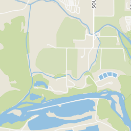
Rings at ½ mile and 1 mile. Basemap © OpenMapTiles © OpenStreetMap contributors.
Open the Springfield camera map11 CCTV cameras mapped within ½ mile of this home. Nearest: less than 0.1 mi southwest. Operator named in the data: CenturyLink.
| Device type | Within ½ mi | Within 1 mi |
|---|---|---|
| License-plate readers | 0 | 1 |
| of which Flock Safety | 0 | 1 |
| CCTV cameras | 11 | 14 |
Community-reported via OpenStreetMap; may be incomplete. Data as of . © OpenStreetMap contributors (ODbL)
License-plate readers (ALPR) are fixed cameras that photograph passing vehicles and read their plates. Records are typically shared with the agency or association that operates the camera.
Flock Safety is a company whose plate-reader cameras are used by police departments, cities, HOAs and businesses. Its devices are usually solar-powered and pole-mounted.
CCTV cameras are fixed video cameras that record a street, building or other area.
Within 2 miles of this home: 39+ restaurants and cafés, 10 grocery stores, 31 parks and green spaces, and 23+ transit stops.
Place data from OpenStreetMap.
Charred Apizza
Main Street
Cornucopia
Main Street
The Pump Cafe
Main Street
Mezza Luna
Main Street
Memo’s
Mexican restaurant
Hoshi Sushi Teriyaki
Sardarni's Kitchen
Indian restaurant · Main Street
The Monkey's Paw
Main Street
Erica’s Meat Market
Main Street
Grocery Outlet
South 14th Street
Centennial Center
Centennial Market
Fred Meyer
Q Street
El Angel Meat Market
Safeway
Q Street
WinCo Foods
Olympic Street
Old Springfield IOOF Cemetery
Millrace Park
South Mill Street
Island Park
West B Street
Willamette Heights Park
Meadow Park
Mill Street
Willamalane Park
G Street
James Park
East 19th Avenue
Kelly Butte Park Overlook
Summit Boulevard
Greyhound Eugene-Springfield
Springfield Station Bay H
Springfield Station 5th St Arrival Zone
Springfield Station Bay B
Springfield Station Bay A
Springfield Station Bay C
Springfield Station Bay D
Springfield Station