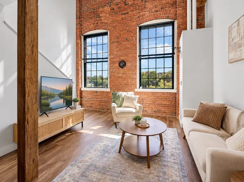
 Price Reduced19
$309,000
1 bd · 2 ba · 871 sqft
48 Water St #405, Worcester, MA


No listing photos
2
Beds
1.5
Baths
1,080
Sqft
1986
Year built
Range $294,301 – $305,953 · as of August 30, 2026
ATTOM automated valuation model · 54 published estimates over 6.7 years · shaded band is the model's own published low-to-high range
Highest reading $319,829 in December 2025; lowest $137,300 in February 2020. The vertical scale starts at the series' own low, not at zero — it is drawn to show movement, not absolute size.
$60,025
Estimated monthly payment
$2,054/mo
Loan amount $240,102. Estimate only — your actual rate and payment depend on credit, location, and lender.
2025 roll
School ratings (A+ to F) from HJN community data.
Rice Square
KG-6 · Regular · Worcester School District
502 students · 15.3:1 student–teacher
Worcester East Middle School
7-8 · Regular · Worcester School District
731 students · 14.3:1 student–teacher
Worcester Cultural Academy Charter Public School
KG-5 · Regular · Worcester Cultural Academy Charter Public School
194 students · 14.6:1 student–teacher
Union Hill School
KG-6 · Regular · Worcester School District
377 students · 13.1:1 student–teacher
Worcester Academy
6-12 · Regular
508 students · 6.2:1 student–teacher
St Paul Diocesan Jr/Sr High School
7-12 · Regular
486 students · 13.7:1 student–teacher
Grafton Street
KG-6 · Regular · Worcester School District
386 students · 11.5:1 student–teacher
Vernon Hill School
PK-6 · Regular · Worcester School District
525 students · 13.4:1 student–teacher
Some properties which appear for sale on this web site may subsequently have sold or may no longer be available.
Alyssa Coyle · William Raveis R.E. & Home Services
 MLS Property Information Network (MLS PIN)
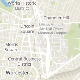
Rings at ½ mile and 1 mile. Basemap © OpenMapTiles © OpenStreetMap contributors.
Open the Worcester camera map3 devices mapped within 1 mile of this home: 1 license-plate reader and 2 CCTV cameras; one of them identified as a Flock Safety device. None within ½ mile. Nearest: 0.9 mi northwest. Operators named in the data: Massachusetts Department of Transportation and Worcester Police.
| Device type | Within ½ mi | Within 1 mi |
|---|---|---|
| License-plate readers | 0 | 1 |
| of which Flock Safety | 0 | 1 |
| CCTV cameras | 0 | 2 |
Community-reported via OpenStreetMap; may be incomplete. Data as of . © OpenStreetMap contributors (ODbL)
License-plate readers (ALPR) are fixed cameras that photograph passing vehicles and read their plates. Records are typically shared with the agency or association that operates the camera.
Flock Safety is a company whose plate-reader cameras are used by police departments, cities, HOAs and businesses. Its devices are usually solar-powered and pole-mounted.
CCTV cameras are fixed video cameras that record a street, building or other area.
Within 2 miles of this home: 40+ restaurants and cafés, 10 grocery stores, 39+ parks and green spaces, and 10 transit stops.
Place data from OpenStreetMap.
Philly Pretzel Factory
Grafton Street
Palma's Bakery
Rice Square
Cedar Box Lounge
Hamilton Street
Gibby's
Sunderland Road
Vincent's
Suffolk Street
Vernon Pizza
Vernon Street
The Blackstone Pub
Water Street
Honey Dew
Grafton Street
Price Chopper
Sunderland Road
Gibson's Dairy
Worcester Public Market
Stop & Shop
Grafton Street
Walmart Supercenter
Tobias Boland Way
Price Rite
Southbridge Street
BCP Electric LLC
Jackson Street
Cebao Market
Main Street
Mulcahy Field
Banis St Playground
Shale St Playground
Vernon Hill Playground
Crow Hill & Fitzgerald Brook Conservation Restriction
Holmes Field
Great Heron Pond
Plymouth St. Playground
Vernon St + Windham St
Worcester
PVTA B79 - Union Station
Worcester - Commuter Rail and Amtrak
MART: Worcester Shuttle
Worcester Bus Station
Union Station Hub
Foster Street
Belmont Street + Oden Avenue