84
$4,750,000
5 bd · 5 ba · 4,631 sqft
2360 NE 49th Street, Lighthouse Point, FL
Kacie Marie Anderson · EXP Realty


No listing photos
—
Beds
—
Baths
9,256
Sqft
1967
Year built
2026 roll
School ratings (A+ to F) from HJN community data.
Norcrest Elementary School
KG-5 · Regular · Broward County School District
678 students · 18.3:1 student–teacher
Trinity Christian School
KG-5 · Regular
85 students · 15.4:1 student–teacher
Somerset Pines Academy
KG-8 · Regular · Broward County School District
447 students · 23.5:1 student–teacher
Education Station Preschool
KG-4 · Regular
30 students · 7.7:1 student–teacher
Hosanna Christian Academy
KG-11 · Special Program Emphasis
18 students · 6.9:1 student–teacher
Lighthouse Christian School
KG-8 · Regular
141 students · 8.8:1 student–teacher
Crystal Lake Middle School
6-8 · Regular · Broward County School District
925 students · 21.5:1 student–teacher
Cresthaven Elementary School
PK-5 · Regular · Broward County School District
421 students · 15.0:1 student–teacher
BeachesMLS MIAMI REALTORS MLS
Some properties which appear for sale on this web site may subsequently have sold or may no longer be available.
84$4,750,000
5 bd · 5 ba · 4,631 sqft
2360 NE 49th Street, Lighthouse Point, FL
Kacie Marie Anderson · EXP Realty
 20
$545,000
3 bd · 2 ba · 1,384 sqft
1686 NE 30th St, Pompano Beach, FL
Johnjon Gonzalez · Luxe Properties
 Price Reduced36
$299,000
2 bd · 2 ba · 1,207 sqft
220 S Golf Blvd, Pompano Beach, FL
Fernando Alejandre · Canvas Real Estate
 Price Reduced66
$5,980,000
5 bd · 5 ba · 5,962 sqft
2820 NE 44th St, Lighthouse Point, FL
Sandra Rathe · Real Broker LLC
 16
$445,500
3 bd · 2 ba · 1,232 sqft
2448 NE 13th Avenue, Pompano Beach, FL
David L Bourns · Society Realty
 Price Reduced49
$998,000
3 bd · 2 ba · 1,799 sqft
2910 NE 40th Court, Lighthouse Point, FL
Kolec N Ndoja · RE/MAX FIRST
Rings at ½ mile and 1 mile. Basemap © OpenMapTiles © OpenStreetMap contributors.
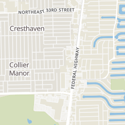
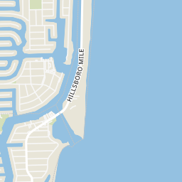
Open the Pompano Beach camera map8 license-plate readers mapped within 1 mile of this home, 4 of them identified as Flock Safety devices. None within ½ mile. Nearest: 0.6 mi southeast. Operator named in the data: Broward County, FLA.
| Device type | Within ½ mi | Within 1 mi |
|---|---|---|
| License-plate readers | 0 | 8 |
| of which Flock Safety | 0 | 4 |
Community-reported via OpenStreetMap; may be incomplete. Data as of . © OpenStreetMap contributors (ODbL)
License-plate readers (ALPR) are fixed cameras that photograph passing vehicles and read their plates. Records are typically shared with the agency or association that operates the camera.
Flock Safety is a company whose plate-reader cameras are used by police departments, cities, HOAs and businesses. Its devices are usually solar-powered and pole-mounted.
Within 2 miles of this home: 18 restaurants and cafés, 9 grocery stores, 27 parks and green spaces, and 30+ transit stops.
Place data from OpenStreetMap.
Taco Bell
East Sample Road
Dunkin
Arby's
North Federal Highway
Red Fox Diner
American restaurant
BurgerFi
Federal Highway
McDonald's
North Federal Highway
Dairy Queen
Federal Highway
Boston Market
Publix
North Federal Highway
Rio's Meat Market & Grocery
Federal Highway
Whole Foods Market
North Federal Highway
Bravo
North Dixie Highway
Walmart Supercenter
North Federal Highway
Family Budget Supermarket
NE 5th Avenue
La supermarkette 2
North Dixie Highway
Ali Market
Sandspur Park
Highlands Scrub Natural Area
Placid Park
Venetian Park
North Broward County Park
Deerfield Highlands Nature Reserve
NE 5th Ave
Dan Witt Park
Dixon Ahl Park
Sample Road/Northeast 16th Terrace
Sample Road/Northeast 17th Avenue
US 1/Sample Road (South)
US 1 & Sample Road
US 1/Sample Road (North)
Sample Road/Northeast 13th Terrace
Northeast 33rd Street/Northeast 15th Avenue
Northeast 33rd Street/US 1
North Dixie Highway