 Price Reduced1

$26,500
2 bd · 1 ba · 672 sqft
2110 Wolcott Street, Flint, MI
Ahmed ''Ali'' Khalil · Real Broker, LLC · on 3 MLSs


No listing photos
—
Beds
—
Baths
—
Sqft
—
Year built
Range $31,072 – $40,926 · as of August 30, 2026
ATTOM automated valuation model · 54 published estimates over 6.7 years · shaded band is the model's own published low-to-high range
Highest reading $64,157 in January 2025; lowest $25,500 in April 2020. The vertical scale starts at the series' own low, not at zero — it is drawn to show movement, not absolute size.
$7,200
Estimated monthly payment
$346/mo
Loan amount $28,799. Estimate only — your actual rate and payment depend on credit, location, and lender.
2026 roll
School ratings (A+ to F) from HJN community data.
McMonagle Elementary School
KG-6 · Regular · Westwood Heights Schools
304 students · 17.1:1 student–teacher
Academy West Alternative Education
6-12 · Alternative/Other · Westwood Heights Schools
199 students · 22.6:1 student–teacher
Hamady High School
9-12 · Regular · Westwood Heights Schools
397 students · 16.3:1 student–teacher
Hamady Middle School
7-8 · Regular · Westwood Heights Schools
154 students · 13.8:1 student–teacher
Flex High North Flint
9-12 · Alternative/Other · Flex High School of Michigan
160 students · 28.6:1 student–teacher
Michael Hamady Elementary School
KG-1 · Regular · Westwood Heights Schools
131 students · 16.0:1 student–teacher
Eagles Nest Academy
KG-6 · Regular · Eagle's Nest Academy
154 students · 14.0:1 student–teacher
Brownell STEM Academy
KG-5 · Regular · Flint City School District
160 students · 11.7:1 student–teacher
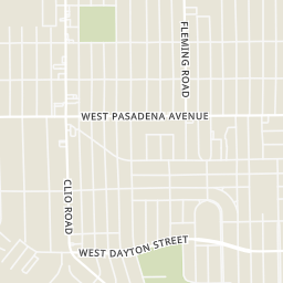
Rings at ½ mile and 1 mile. Basemap © OpenMapTiles © OpenStreetMap contributors.
Open the Flint camera map1 license-plate reader mapped within ½ mile of this home, identified as a Flock Safety device. Nearest: 0.2 mi south. Operator named in the data: Mount Morris Township Police Department.
| Device type | Within ½ mi | Within 1 mi |
|---|---|---|
| License-plate readers | 1 | 7 |
| of which Flock Safety | 1 | 7 |
Community-reported via OpenStreetMap; may be incomplete. Data as of . © OpenStreetMap contributors (ODbL)
License-plate readers (ALPR) are fixed cameras that photograph passing vehicles and read their plates. Records are typically shared with the agency or association that operates the camera.
Flock Safety is a company whose plate-reader cameras are used by police departments, cities, HOAs and businesses. Its devices are usually solar-powered and pole-mounted.
MiRealSourceSome properties which appear for sale on this web site may subsequently have sold or may no longer be available.
Price Reduced1$26,500
2 bd · 1 ba · 672 sqft
2110 Wolcott Street, Flint, MI
Ahmed ''Ali'' Khalil · Real Broker, LLC · on 3 MLSs
 Price Reduced1
$44,000
4 bd · 2 ba · 2,304 sqft
1909 Proctor Avenue, Flint, MI
Antonio Deleone · The Brand Real Estate · on 2 MLSs
 9
$42,900
2 bd · 1 ba · 1,732 sqft
3106 W Pierson Road, Flint, MI
Steve Koleno · Beycome Brokerage Realty LLC
 3
$35,000
3 bd · 2 ba · 1,366 sqft
2229 Mallery Street, Flint, MI
John Sedlarik · The Sedlarik Group Realty LLC
 10
$40,000
2 bd · 1 ba · 684 sqft
3035 Raskob Street, Flint, MI
Rebecca Roth · Hamady Robinson, REALTORS®
 2
$33,000
2 bd · 1 ba · 744 sqft
2637 Winona Street, Flint, MI
Amy Garza · HamadyRobinson, REALTORS®
Within 2 miles of this home: 21 restaurants and cafés, 2 grocery stores, 7 parks and green spaces, and 13+ transit stops.
Place data from OpenStreetMap.
Papa's Drive-Thru
Subway
West Pierson Road
McDonald's
West Pierson Road
Cracker Barrel
American restaurant · Pier North Parkway
Arby's
West Pierson Road
Tim Hortons
West Pierson Road
YaYa's
Happy's Pizza
North Flint Market
Clio Road
ALDI
West Pierson Road
American Legion Fields
Sarvis Park
Fleming Park
Flint Park Lake
Flint Lake Park
D. Hamilton Field and Recreation Area
Hasselbring Park
Pierson Road & Jennings Road
Pierson Road & Hunter Road
Pierson Road at 4000 Block
Pierson Road & Minerva Drive
Pierson Road & Dolan Drive
Pierson Road & Doran Street
Pierson Road & Orgould Street
Pierson Road & Clio Road