30

$389,000
1 bd · 2 ba · 800 sqft
2000 County Road 2513, Decatur, TX
Tom White · Century 21 Mike Bowman, Inc.

No listing photos
—
Beds
2
Baths
1,747
Sqft
1998
Year built
Range $334,439 – $375,665 · as of October 21, 2026
ATTOM automated valuation model · 55 published estimates over 6.8 years · shaded band is the model's own published low-to-high range
Highest reading $425,853 in January 2023; lowest $263,000 in April 2020. The vertical scale starts at the series' own low, not at zero — it is drawn to show movement, not absolute size.
$71,010
Estimated monthly payment
$2,386/mo
Loan amount $284,042. Estimate only — your actual rate and payment depend on credit, location, and lender.
2026 roll
North Texas Real Estate Information Systems (NTREIS)Some properties which appear for sale on this web site may subsequently have sold or may no longer be available.
30$389,000
1 bd · 2 ba · 800 sqft
2000 County Road 2513, Decatur, TX
Tom White · Century 21 Mike Bowman, Inc.
 19
$350,000
3 bd · 2 ba · 2,245 sqft
3005 S College Avenue, Decatur, TX
Amber Broadway · Opendoor Brokerage, LLC
 33
$449,900
4 bd · 2 ba · 2,229 sqft
164 Hillview Trail, Decatur, TX
Clinton Shipley · NTex Realty, LP
 40
$320,000
3 bd · 3 ba · 1,710 sqft
201 S Cates Street, Decatur, TX
Monica Spence · Spence Real Estate Group LLC
 17
$420,000
3 bd · 2 ba · 1,585 sqft
202 Valley Meadow Drive, Decatur, TX
Kevin Kikalo · Texas Signature Realty
 33
$298,500
3 bd · 3 ba · 1,816 sqft
287 Emma Call Court, Decatur, TX
Susan Anderson · Briggs Freeman Sotheby's Int'l
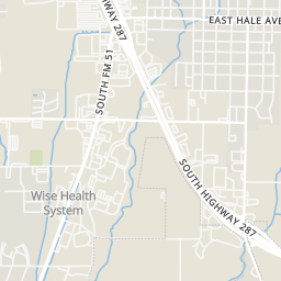
Within 2 miles of this home: 28 restaurants and cafés, 2 grocery stores, and 3 parks and green spaces.
Place data from OpenStreetMap.
Casa Torres
Mexican restaurant
Good Morning Donuts
Wendy's
South FM 51
Sonic
FM 51 South
Burger King
South FM 51
Cicis
South FM 51
Subway
South Highway 287
Jack in the Box
South Highway 287
Lowe's Market
South FM 51
Walmart Supercenter
South Highway 287
Kenny Renshaw Park
Wise County Veteran's Park
Harmon Park
Rings at ½ mile and 1 mile. Basemap © OpenMapTiles © OpenStreetMap contributors.
Open the Decatur camera map5 license-plate readers mapped within 1 mile of this home, all identified as Flock Safety devices. None within ½ mile. Nearest: 0.9 mi northeast.
| Device type | Within ½ mi | Within 1 mi |
|---|---|---|
| License-plate readers | 0 | 5 |
| of which Flock Safety | 0 | 5 |
Community-reported via OpenStreetMap; may be incomplete. Data as of . © OpenStreetMap contributors (ODbL)
License-plate readers (ALPR) are fixed cameras that photograph passing vehicles and read their plates. Records are typically shared with the agency or association that operates the camera.
Flock Safety is a company whose plate-reader cameras are used by police departments, cities, HOAs and businesses. Its devices are usually solar-powered and pole-mounted.
School ratings (A+ to F) from HJN community data.
STEM Academy at Enis Elementary School
KG-5 · Regular · Decatur Independent School District
380 students · 16.0:1 student–teacher
McCarroll Middle School
6-8 · Regular · Decatur Independent School District
838 students · 16.1:1 student–teacher
Rann Elementary School
PK-5 · Regular · Decatur Independent School District
471 students · 13.2:1 student–teacher