30
$4,999,000
5 bd · 5 ba · 3,344 sqft
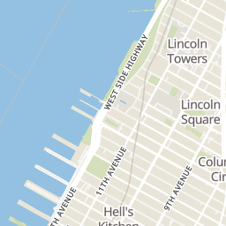
220 Riverside Boulevard Unit 39C, New York City, NY
Ann Cutbill Lenane · Douglas Elliman Real Estate


No listing photos
—
Beds
—
Baths
2,452
Sqft
2004
Year built
Range $3,832,437 – $4,523,274 · as of August 30, 2026
ATTOM automated valuation model · 54 published estimates over 6.7 years · shaded band is the model's own published low-to-high range
Highest reading $4,744,214 in July 2026; lowest $2,059,632 in October 2025. The vertical scale starts at the series' own low, not at zero — it is drawn to show movement, not absolute size.
$835,571
Estimated monthly payment
$26,906/mo
Loan amount $3,342,284. Estimate only — your actual rate and payment depend on credit, location, and lender.
2026 roll
School ratings (A+ to F) from HJN community data.
West End Day School
UG-UG · Special Education
43 students · 3.2:1 student–teacher
P.S. 199 Jessie Isador Straus School
KG-5 · Regular · New York City Geographic School District 03
570 students · 13.6:1 student–teacher
Manhattan Star Academy
UG-UG · Special Education
118 students · 7.4:1 student–teacher
Manhattan/Hunter Science High School
9-12 · Regular · New York City Geographic School District 03
447 students · 14.0:1 student–teacher
High School of Arts and Technology
9-12 · Regular · New York City Geographic School District 03
392 students · 9.2:1 student–teacher
High School for Law, Advocacy and Community Justice
9-12 · Regular · New York City Geographic School District 03
531 students · 11.8:1 student–teacher
Urban Assembly School for Media Studies
9-12 · Regular · New York City Geographic School District 03
331 students · 9.2:1 student–teacher
Special Music School
KG-12 · Regular · New York City Geographic School District 03
305 students · 10.3:1 student–teacher
Some properties which appear for sale on this web site may subsequently have sold or may no longer be available.
 Real Estate Board of New York (REBNY)
Rings at ½ mile and 1 mile. Basemap © OpenMapTiles © OpenStreetMap contributors.
Open the New York camera map45 devices mapped within 1 mile of this home: 11 license-plate readers and 34 CCTV cameras. None within ½ mile. Nearest: 0.5 mi south. Operators named in the data: Metropolitan Transportation Authority, Fordham University, and NYC Department of Transportation.
| Device type | Within ½ mi | Within 1 mi |
|---|---|---|
| License-plate readers | 0 | 11 |
| CCTV cameras | 0 | 34 |
Community-reported via OpenStreetMap; may be incomplete. Data as of . © OpenStreetMap contributors (ODbL)
License-plate readers (ALPR) are fixed cameras that photograph passing vehicles and read their plates. Records are typically shared with the agency or association that operates the camera.
CCTV cameras are fixed video cameras that record a street, building or other area.
Within 2 miles of this home: 40+ restaurants and cafés, 31+ grocery stores, 39+ parks and green spaces, and 28+ transit stops.
Place data from OpenStreetMap.
Pier i Cafe
Kossar’s Bagels & Bialys
West 72nd Street
Giacomo Fine Food
West 72nd Street
Ashford & Simpson's Sugar Bar
West 72nd Street
Emerald Inn
West 72nd Street
Sushi Yasaka
Japanese restaurant · West 72nd Street
Kebab aur Sharab
Indian restaurant · West 72nd Street
Picky Barista
West 72nd Street
Jubilee Market Place
Fairway Market
Broadway
Trader Joe's
Broadway
Citarella
Broadway
H Mart
Asian restaurant · Amsterdam Avenue
Morton Williams
Broadway
JNH Produce
Columbus Avenue
Brooklyn Fare
West End Avenue
Riverside Park
West 72nd Street Dog Run
Riverside Park South Dog Run
Septuagesimo Uno
Little Engine Playground
Hamilton Fountain
Riverside Park South
(Neufeld Playground) Children's Play Area
West 72nd Street & West End Avenue
West End Avenue & West 72nd Street
West End Avenue & West 70th Street
West End Avenue & West 69th Street
West 72nd Street & Broadway
West 72nd Street / Broadway
Broadway & West 74th Street
72nd Street