Price Reduced59
$1,295,000
5 bd · 5 ba · 4,426 sqft
529 Nautilus Dr., Murrells Inlet, SC


No listing photos
4
Beds
3
Baths
4,278
Sqft
2008
Year built
Range $858,977 – $1,261,607 · as of August 30, 2026
ATTOM automated valuation model · 8 published estimates over 6.7 years · shaded band is the model's own published low-to-high range
Highest reading $1,060,292 in August 2026; lowest $411,000 in January 2020. The vertical scale starts at the series' own low, not at zero — it is drawn to show movement, not absolute size.
$212,058
Estimated monthly payment
$6,835/mo
Loan amount $848,234. Estimate only — your actual rate and payment depend on credit, location, and lender.
2025 roll
School ratings (A+ to F) from HJN community data.
St Michael Catholic School
PK-6 · Regular
82 students · 9.2:1 student–teacher
St. James High School
9-12 · Regular · Horry County School District
1,826 students · 17.6:1 student–teacher
Seaside Elementary School
PK-4 · Regular · Horry County School District
398 students · 12.4:1 student–teacher
St. James Middle School
7-8 · Regular · Horry County School District
913 students · 15.7:1 student–teacher
St. James Elementary School
PK-4 · Regular · Horry County School District
884 students · 15.9:1 student–teacher
Within 2 miles of this home: 40+ restaurants and cafés, 5 grocery stores, and 5 parks and green spaces.
Place data from OpenStreetMap.
Subway
Highway 17
Carolina Food Park
Courtfield Drive
Hachiya Japanese Steakhouse
Japanese restaurant
Carrabba's Italian Grill
Italian restaurant
Fox's Pizza Den
Spring House Family Restaurant
China Chef
Some properties which appear for sale on this web site may subsequently have sold or may no longer be available.
Jersey Mike's Subs
Food Lion
Publix
Highway 707
Lowes Foods
Highway 707
Lee's Farmer Market
Walmart Neighborhood Market
Highway 17
Wachesaw Park
The Park at The Bays
Murrells Inlet Historic District
Morse Landing Park
Starbuck Lake
Tradd Residential
 59

$1,299,000
4 bd · 5 ba · 4,020 sqft
110 Hagar Brown Rd., Murrells Inlet, SC
Realty ONE Group Dockside
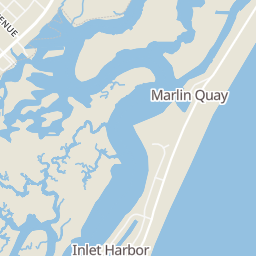
Rings at ½ mile and 1 mile. Basemap © OpenMapTiles © OpenStreetMap contributors.
Open the Murrells Inlet camera map1 license-plate reader mapped within 1 mile of this home, identified as a Flock Safety device. None within ½ mile. Nearest: 0.8 mi northeast.
| Device type | Within ½ mi | Within 1 mi |
|---|---|---|
| License-plate readers | 0 | 1 |
| of which Flock Safety | 0 | 1 |
Community-reported via OpenStreetMap; may be incomplete. Data as of . © OpenStreetMap contributors (ODbL)
License-plate readers (ALPR) are fixed cameras that photograph passing vehicles and read their plates. Records are typically shared with the agency or association that operates the camera.
Flock Safety is a company whose plate-reader cameras are used by police departments, cities, HOAs and businesses. Its devices are usually solar-powered and pole-mounted.
Coastal Carolinas Association of REALTORS