New75
$1,449,000
4 bd · 2 ba · 2,622 sqft
17253 Saint Andrews Dr, Poway, CA


No listing photos
4
Beds
2
Baths
2,238
Sqft
1990
Year built
Range $1,327,008 – $1,472,214 · as of August 30, 2026
ATTOM automated valuation model · 54 published estimates over 6.7 years · shaded band is the model's own published low-to-high range
Highest reading $1,511,776 in July 2024; lowest $818,875 in March 2020. The vertical scale starts at the series' own low, not at zero — it is drawn to show movement, not absolute size.
$279,922
Estimated monthly payment
$9,152/mo
Loan amount $1,119,689. Estimate only — your actual rate and payment depend on credit, location, and lender.
2026 roll
School ratings (A+ to F) from HJN community data.
Childrens Preschool Learning Center
PK-KG · Early Childhood Program/Child Care Center
3 students · 3.0:1 student–teacher
Meadowbrook Middle School
6-8 · Regular · Poway Unified School District
972 students · 21.2:1 student–teacher
Abraxas Continuation High School
9-12 · Alternative/Other · Poway Unified School District
216 students · 9.8:1 student–teacher
Midland Elementary School
KG-5 · Regular · Poway Unified School District
580 students · 21.7:1 student–teacher
Valley Elementary School
KG-5 · Regular · Poway Unified School District
663 students · 21.9:1 student–teacher
Pomerado Elementary School
KG-5 · Regular · Poway Unified School District
305 students · 20.1:1 student–teacher
The Growing Place Montessori
PK-TKG · Early Childhood Program/Child Care Center
2 students · 0.3:1 student–teacher
Newbridge School
1-8 · Special Education
97 students · 6.6:1 student–teacher
Some properties which appear for sale on this web site may subsequently have sold or may no longer be available.
Pacific Sotheby's International Realty · on 3 MLSs
 The MLS (CLAW)
 California Regional Multiple Listing Service (CRMLS)
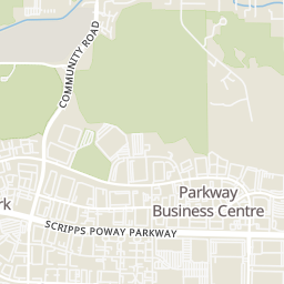
Rings at ½ mile and 1 mile. Basemap © OpenMapTiles © OpenStreetMap contributors.
Open the Poway camera map7 devices mapped within 1 mile of this home: 5 license-plate readers and 2 CCTV cameras; 5 of them identified as Flock Safety devices. None within ½ mile. Nearest: 0.8 mi south. Operator named in the data: Walmart.
| Device type | Within ½ mi | Within 1 mi |
|---|---|---|
| License-plate readers | 0 | 5 |
| of which Flock Safety | 0 | 5 |
| CCTV cameras | 0 | 2 |
Community-reported via OpenStreetMap; may be incomplete. Data as of . © OpenStreetMap contributors (ODbL)
License-plate readers (ALPR) are fixed cameras that photograph passing vehicles and read their plates. Records are typically shared with the agency or association that operates the camera.
Flock Safety is a company whose plate-reader cameras are used by police departments, cities, HOAs and businesses. Its devices are usually solar-powered and pole-mounted.
CCTV cameras are fixed video cameras that record a street, building or other area.
Within 2 miles of this home: 40+ restaurants and cafés, 11 grocery stores, 19 parks and green spaces, and 31+ transit stops.
Place data from OpenStreetMap.
Taco Bell
Poway Road
Lumpia House
Poway Road
Gelato Sweet Spot
Poway Road
Pit Stop Sports Bar
The Olde Carriage Tavern
Poway Road
Salsa Mexican Food
Poway Road
Cully's Restaurant
Poway Road
Poway Social House
Community Road
ALDI
Poway Road
Poway Farmer's Market
Walmart Supercenter
Community Road
Old Poway Market
Midland Road
Sprouts Farmers Market
Poway Road
Stater Bros
Poway Road
Trader Joe's
Poway Road
North Park Produce
Poway Road
Starridge Park
Carriage Road
Hilleary Park
Abraxas Garden
Old Poway Park
Midland Road
Ipai Waaypuk
Aubrey Park
Aubrey Street
Poway Community Park
Veterans Park
Poway Road & 12900
Pomerado Road & Vaughan Road
Poway Road & Carriage Heights Way
Poway Road & Carriage Road
Pomerado Road & Meadowbrook Ln
Poway Road & Tarascan Road
Poway Road & Quate Center
Pomerado Road & Holland Road