59

$999,000
3 bd · 3 ba · 2,950 sqft
175 Fortson Dr, Athens, GA
Gena N Knox · Dwell Real Estate


No listing photos
—
Beds
—
Baths
2,748
Sqft
1940
Year built
2025 roll
Georgia MLS Hive MLS (North Carolina Regional)
Some properties which appear for sale on this web site may subsequently have sold or may no longer be available.
59$999,000
3 bd · 3 ba · 2,950 sqft
175 Fortson Dr, Athens, GA
Gena N Knox · Dwell Real Estate
 Price Reduced27
$180,000
2 bd · 3 ba · 1,168 sqft
637 Huntington Rd Unit C2, Athens, GA
Ashley Nalley · Keller Williams Greater Athens · on 2 MLSs
 12
$449,000
3 bd · 2 ba · 1,305 sqft
2206 S Lumpkin Street, Athens, GA
David Hamilton · The Hamilton Agency Inc
 Price Reduced50
$485,000
3 bd · 3 ba · 2,101 sqft
232 Westpark Drive, Athens, GA
Allen Seigler · Greater Athens Properties
 24
$329,990
4 bd · 4 ba · 1,912 sqft
120 Tremont Pkwy, Athens, GA
Ellen West · RAC Properties of Athens, Inc.
 Price Reduced35
$299,500
3 bd · 2 ba · 1,682 sqft
315 Forest Heights Dr, Athens, GA
Jared Marsden · Keller Williams Greater Athens
School ratings (A+ to F) from HJN community data.
Clarke Central High School
9-12 · Regular · Clarke County School District
1,907 students · 15.9:1 student–teacher
Classic City High School
9-12 · Regular · Clarke County School District
58 students · 8.3:1 student–teacher
Johnnie Lay Burks Elementary School
PK-5 · Regular · Clarke County School District
492 students · 11.2:1 student–teacher
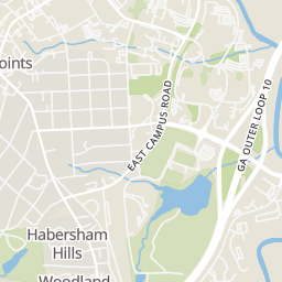
Rings at ½ mile and 1 mile. Basemap © OpenMapTiles © OpenStreetMap contributors.
Open the Athens camera map7 license-plate readers mapped within ½ mile of this home, all identified as Flock Safety devices. Nearest: 0.4 mi south.
| Device type | Within ½ mi | Within 1 mi |
|---|---|---|
| License-plate readers | 7 | 27 |
| of which Flock Safety | 7 | 27 |
Community-reported via OpenStreetMap; may be incomplete. Data as of . © OpenStreetMap contributors (ODbL)
License-plate readers (ALPR) are fixed cameras that photograph passing vehicles and read their plates. Records are typically shared with the agency or association that operates the camera.
Flock Safety is a company whose plate-reader cameras are used by police departments, cities, HOAs and businesses. Its devices are usually solar-powered and pole-mounted.
Within 2 miles of this home: 40+ restaurants and cafés, 8 grocery stores, 40+ parks and green spaces, and 39+ transit stops.
Place data from OpenStreetMap.
Gresham's Disco Lounge
West Broad Street
Tamez BBQ
West Broad Street
The Bar @ Saucehouse
Saucehouse
West Broad Street
Ideal Bagel Co
West Broad Street
Dondero’s
North Milledge Avenue
Cook Out
American restaurant · West Broad Street
The Taco Stand
Mexican restaurant · North Milledge Avenue
Kroger
Alps Road
Target
East Broad Street
The Fresh Market
Alps Road
Lay-Z-Shopper Convenience Store
East Clayton Street
Earth Fare
South Lumpkin Street
Athens Farmers Market
Bells Supermarket
Dollar General Market
Jefferson Road
West Hancock Avenue Historic District
West Broad Community Garden
Waddell Street
Rocksprings Park
Henderson Extension
Cobbham Historic District Neighborhood Park
Cobbham Triangle Park
Reese & Pope Park
Reese Street
Auxillary Healing Garden
Bloomfield Street Historic District
West Broad Street at South Rocksprings Street Inbound
West Broad Street at Billups Street Outbound
West Broad Street at South Chase Street Inbound
West Broad Street at Broadacres Outbound
Broad and Milledge Inbound
West Broad Street at Minor Street Inbound
Broad and Milledge Outbound
Lucy Cobb