17

$1,325,000
4 bd · 3 ba · 1,844 sqft
14 Gleason Rd, Lexington, MA
William Morley · Martin Property Management


No listing photos
4
Beds
2.5
Baths
2,063
Sqft
1956
Year built
Range $1,641,443 – $1,819,873 · as of August 30, 2026
ATTOM automated valuation model · 55 published estimates over 6.7 years · shaded band is the model's own published low-to-high range
Highest reading $1,821,385 in July 2026; lowest $978,215 in April 2020. The vertical scale starts at the series' own low, not at zero — it is drawn to show movement, not absolute size.
$346,132
Estimated monthly payment
$11,214/mo
Loan amount $1,384,526. Estimate only — your actual rate and payment depend on credit, location, and lender.
2026 roll
School ratings (A+ to F) from HJN community data.
Joseph Estabrook Elementary School
KG-5 · Regular · Lexington School District
490 students · 11.3:1 student–teacher
Fusion Academy Burlington
6-12 · Regular
26 students · 1.3:1 student–teacher
William Diamond Middle School
6-8 · Regular · Lexington School District
936 students · 9.4:1 student–teacher
Fiske Elementary School
KG-5 · Regular · Lexington School District
324 students · 9.1:1 student–teacher
New England Innovation Academy
6-10 · Special Program Emphasis
76 students · 6.9:1 student–teacher
Primrose School of Burlington
PK-KG · Early Childhood Program/Child Care Center
20 students · 10.0:1 student–teacher
Fuse School
PK-1 · Special Education
18 students · 4.5:1 student–teacher
Bedford Montessori School
PK-KG · Montessori
4 students · 0.6:1 student–teacher
Within 2 miles of this home: 40+ restaurants and cafés, 5 grocery stores, 37+ parks and green spaces, and 37+ transit stops.
Place data from OpenStreetMap.
Eddie V's Prime Seafood
South Avenue
Buffalo Wild Wings
South Avenue
Kings Bowl
American restaurant · Second Avenue
Twist Bakery & Cafe
Second Avenue
Market Cafe
Border Cafe
Middlesex Turnpike
Yard House
American restaurant · Middlesex Turnpike
The OkiPoké
Japanese restaurant · Third Avenue
Wegmans
Third Avenue
Trader Joe's
Middlesex Turnpike
H Mart
Asian restaurant · Old Concord Road
Market Basket
Middlesex Turnpike
Stop & Shop
The Great Road
Paint Mine Conservation Area
Muskrat Ponds
Burlington Strip
Turning Mill Pond
Turning Mill Pond Conservation Area
Landlocked Forest
Justin/Bernard Conservation Land
Justin Park
Turning Mill Road opposite Partridge Road
Turning Mill Road @ Demar Road
Turning Mill Road @ Mountain Road
Turning Mill Road @ Robinson Road
Turning Mill Road opposite Grimes Road
Grove Street @ Royal Circle
Robinson Road @ Grove Street
Grove Street opposite Eldred Street
MLS Property Information Network (MLS PIN)Some properties which appear for sale on this web site may subsequently have sold or may no longer be available.
17$1,325,000
4 bd · 3 ba · 1,844 sqft
14 Gleason Rd, Lexington, MA
William Morley · Martin Property Management
 Price Reduced41
$2,200,000
5 bd · 5 ba · 4,279 sqft
15 Calvin St, Lexington, MA
Northeast Venture Group · Golden Cross Brands Inc.
 Price Reduced26
$1,599,000
4 bd · 3 ba · 1,900 sqft
5 Gould Rd, Lexington, MA
The Janovitz-Tse Team · Compass
 Price Reduced25
$1,399,000
5 bd · 2 ba · 2,400 sqft
15 Grant Street, Lexington, MA
Amie Pettengill · Coldwell Banker Realty - Lexington
 Price Reduced16
$1,399,000
5 bd · 2 ba · 2,400 sqft
15 Grant Street #1, Lexington, MA
Amie Pettengill · Coldwell Banker Realty - Lexington
 Price Reduced29
$1,699,000
4 bd · 3 ba · 3,001 sqft
1 Battleview Circle, Lexington, MA
Beth Sager Group · Keller Williams Realty Boston Northwest
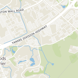
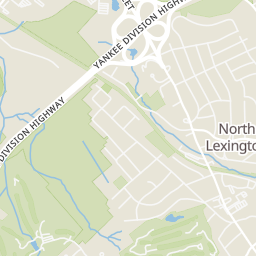
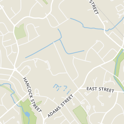
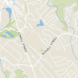
Rings at ½ mile and 1 mile. Basemap © OpenMapTiles © OpenStreetMap contributors.
Open the Lexington camera map5 devices mapped within 1 mile of this home: 2 license-plate readers and 3 CCTV cameras. None within ½ mile. Nearest: 0.7 mi east. Operators named in the data: Massachusetts Department of Transportation and Mass State Police.
| Device type | Within ½ mi | Within 1 mi |
|---|---|---|
| License-plate readers | 0 | 2 |
| CCTV cameras | 0 | 3 |
Community-reported via OpenStreetMap; may be incomplete. Data as of . © OpenStreetMap contributors (ODbL)
License-plate readers (ALPR) are fixed cameras that photograph passing vehicles and read their plates. Records are typically shared with the agency or association that operates the camera.
CCTV cameras are fixed video cameras that record a street, building or other area.