38

$475,000
3 bd · 3 ba · 1,635 sqft
1412 E Banavie Ter E, Bel Air, MD
Tracey Simms · Berkshire Hathaway HomeServices PenFed Realty

No listing photos
—
Beds
2.5
Baths
1,883
Sqft
1988
Year built
Range $500,275 – $561,037 · as of October 21, 2026
ATTOM automated valuation model · 55 published estimates over 6.8 years · shaded band is the model's own published low-to-high range
Highest reading $530,656 in October 2026; lowest $337,808 in April 2020. The vertical scale starts at the series' own low, not at zero — it is drawn to show movement, not absolute size.
$106,131
Estimated monthly payment
$3,508/mo
Loan amount $424,525. Estimate only — your actual rate and payment depend on credit, location, and lender.
2026 roll
School ratings (A+ to F) from HJN community data.
Patterson Mill High School
9-12 · Regular · Harford County Public Schools
839 students · 17.0:1 student–teacher
Patterson Mill Middle School
6-8 · Regular · Harford County Public Schools
716 students · 14.5:1 student–teacher
Emmorton Baptist Academy
KG-12 · Regular
49 students · 7.5:1 student–teacher
Emmorton Elementary School
PK-5 · Regular · Harford County Public Schools
584 students · 16.4:1 student–teacher
William S. James Elementary School
PK-5 · Regular · Harford County Public Schools
463 students · 15.1:1 student–teacher
Ring Factory Elementary School
PK-5 · Regular · Harford County Public Schools
541 students · 16.0:1 student–teacher
Abingdon Elementary School
PK-5 · Regular · Harford County Public Schools
641 students · 13.5:1 student–teacher
Homestead Wakefield Elementary School
PK-5 · Regular · Harford County Public Schools
1,071 students · 17.2:1 student–teacher
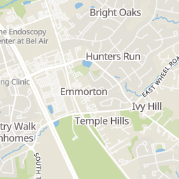
Within 2 miles of this home: 38 restaurants and cafés, 4 grocery stores, 12 parks and green spaces, and 21 transit stops.
Place data from OpenStreetMap.
Pairings Bistro
Laurel Bush Road
Domino's
Old Emmorton Road
Emmorton Snowballs & Ice Cream
East Wheel Road
Burger King
Emmorton Road
Fuji Sushi
Japanese restaurant · Bel Air South Parkway
Vista Pizza
Emmorton Road
Sizzling Bombay
Indian restaurant · Emmorton Road
Route 24 Ale House
Bel Air South Parkway
Village Market and Cafe
Laurel Bush Road
ShopRite
Bel Air South Parkway
Bharosa
Emmorton Road
Giant
Emmorton Road
PlayPlace
Emily Bayless Graham Park
Bynum Run Conservation Area
Maryland Center for the Arts
Emmorton Elementary Park
South Tollgate Road
Marshall E. Kroh Park
Constant Friendship Park
Colonial Acres Community Association Park
Emmorton Road & Belair South Parkway Northbound
Emmorton Road & Belair South Parkway Southbound
Sonic (1921 Emmorton Road/Route 924)
Shell Gas Station (1902 Emmorton Road/Route 924)
Emmorton Road/Route 924 & Saint Mary’s Church Road
Emmorton Road & Holly Wreath Road
Emmorton Road & Holly Wreath Court Northbound
Emmorton Road/Route 924 & Holly Wreath Court
Bright MLSSome properties which appear for sale on this web site may subsequently have sold or may no longer be available.
38$475,000
3 bd · 3 ba · 1,635 sqft
1412 E Banavie Ter E, Bel Air, MD
Tracey Simms · Berkshire Hathaway HomeServices PenFed Realty
 Price Reduced46
$475,000
4 bd · 5 ba · 3,296 sqft
310 S Fountain Green Rd, Bel Air, MD
Kim Barton · Keller Williams Legacy
 Price Reduced68
$624,900
4 bd · 4 ba · 2,746 sqft
1138 Starmount Ct, Bel Air, MD
Danielle Waldera · Keller Williams Gateway LLC
 Price Reduced83
$629,900
3 bd · 3 ba · 2,724 sqft
825 Sidehill Dr, Bel Air, MD
Lee R. Tessier · EXP Realty, LLC
 Price Reduced54
$665,000
4 bd · 4 ba · 4,076 sqft
2014 Royal Fern Ct, Bel Air, MD
Heather A Schafer Adkins · Long & Foster Real Estate, Inc.
 55
$395,000
3 bd · 4 ba · 2,194 sqft
208 Mary Jane Ln, Bel Air, MD
Ming Guo · Northrop Realty
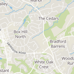
Rings at ½ mile and 1 mile. Basemap © OpenMapTiles © OpenStreetMap contributors.
Open the Bel Air camera map2 CCTV cameras mapped within 1 mile of this home. None within ½ mile. Nearest: 0.8 mi west.
| Device type | Within ½ mi | Within 1 mi |
|---|---|---|
| CCTV cameras | 0 | 2 |
Community-reported via OpenStreetMap; may be incomplete. Data as of . © OpenStreetMap contributors (ODbL)
CCTV cameras are fixed video cameras that record a street, building or other area.