Price Reduced33

$329,500
3 bd · 2 ba · 1,804 sqft
239 W K St, Springfield, OR
Jared English · Congress Realty


No listing photos
2
Beds
1
Baths
1,020
Sqft
1954
Year built
Range $220,203 – $289,853 · as of August 30, 2026
ATTOM automated valuation model · 54 published estimates over 6.7 years · shaded band is the model's own published low-to-high range
Highest reading $415,163 in June 2022; lowest $214,850 in March 2020. The vertical scale starts at the series' own low, not at zero — it is drawn to show movement, not absolute size.
$51,006
Estimated monthly payment
$1,752/mo
Loan amount $204,022. Estimate only — your actual rate and payment depend on credit, location, and lender.
2025 roll
Regional Multiple Listing Service (RMLS)Some properties which appear for sale on this web site may subsequently have sold or may no longer be available.
Price Reduced33$329,500
3 bd · 2 ba · 1,804 sqft
239 W K St, Springfield, OR
Jared English · Congress Realty
 15
$249,900
2 bd · 1 ba · 900 sqft
1985 17th St, Springfield, OR
Jamie Paddock · Elite Realty Professionals
 30
$224,900
2 bd · 2 ba · 880 sqft
650 Harlow Rd Unit 144, Springfield, OR
Nicole Ferrell · Triple Oaks Realty LLC
 38
$268,000
2 bd · 2 ba · 880 sqft
650 Harlow Rd Unit 238, Springfield, OR
Nicole Ferrell · Triple Oaks Realty LLC
 Price Reduced26
$229,900
3 bd · 1 ba · 792 sqft
736 5th St, Springfield, OR
Jill Mestler · Windermere RE Lane County
 48
$268,000
2 bd · 2 ba · 880 sqft
650 Harlow Rd Unit 152, Springfield, OR
Gwendolynn Herndon · MORE Realty
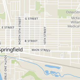
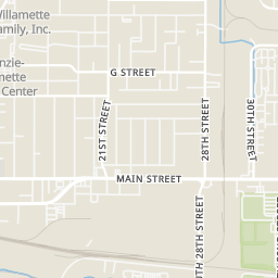
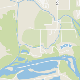
Rings at ½ mile and 1 mile. Basemap © OpenMapTiles © OpenStreetMap contributors.
Open the Springfield camera map6 devices mapped within ½ mile of this home: 1 license-plate reader and 5 CCTV cameras; one of them identified as a Flock Safety device. Nearest: 0.3 mi northeast. Operator named in the data: CenturyLink.
| Device type | Within ½ mi | Within 1 mi |
|---|---|---|
| License-plate readers | 1 | 1 |
| of which Flock Safety | 1 | 1 |
| CCTV cameras | 5 | 17 |
Community-reported via OpenStreetMap; may be incomplete. Data as of . © OpenStreetMap contributors (ODbL)
License-plate readers (ALPR) are fixed cameras that photograph passing vehicles and read their plates. Records are typically shared with the agency or association that operates the camera.
Flock Safety is a company whose plate-reader cameras are used by police departments, cities, HOAs and businesses. Its devices are usually solar-powered and pole-mounted.
CCTV cameras are fixed video cameras that record a street, building or other area.
School ratings (A+ to F) from HJN community data.
Academy of Arts and Academics
9-12 · Regular · Springfield School District 19
231 students · 16.6:1 student–teacher
Gateways High School
9-12 · Regular · Springfield School District 19
101 students · 12.8:1 student–teacher
Springfield High School
9-12 · Regular · Springfield School District 19
1,229 students · 18.7:1 student–teacher
Within 2 miles of this home: 39+ restaurants and cafés, 8 grocery stores, 30 parks and green spaces, and 21+ transit stops.
Place data from OpenStreetMap.
Addi's Diner
American restaurant · South A Street
Los Faroles
Mexican restaurant · South A Street
Franz Bakery Outlet
South A Street
Taco Time
Mexican restaurant · Main Street
Dutch Bros. Coffee
South 5th Street
Lee's Mongolian Grill
Main Street
George + Violets
Main Street
Piro - Latin Scratch Kitchen
Main Street
Erica’s Meat Market
Main Street
Grocery Outlet
South 14th Street
Centennial Center
Centennial Market
El Angel Meat Market
Safeway
Q Street
Fred Meyer
Q Street
WinCo Foods
Olympic Street
Old Springfield IOOF Cemetery
Willamette Heights Park
Millrace Park
South Mill Street
James Park
East 19th Avenue
Island Park
West B Street
Meadow Park
Mill Street
Kelly Butte Park Overlook
Summit Boulevard
West D Street Greenway
Springfield Station Bay E
Springfield Station Bay D
Springfield Station 5th St Arrival Zone
Springfield Station
Springfield Station Bay F
Springfield Station Bay C
Springfield Station Bay B
Springfield Station Bay G