Price Reduced19

$275,000
2 bd · 1 ba · 850 sqft
260 Merrydale Road #14, San Rafael, CA
Nick Flageollet · Compass


No listing photos
2
Beds
1
Baths
864
Sqft
1975
Year built
Range $168,000 – $327,000 · as of April 1, 2020
ATTOM automated valuation model · 4 published estimates over 0.2 years · shaded band is the model's own published low-to-high range
Highest reading $256,000 in February 2020; lowest $227,000 in January 2020. The vertical scale starts at the series' own low, not at zero — it is drawn to show movement, not absolute size.
$49,400
Estimated monthly payment
$1,682/mo
Loan amount $197,600. Estimate only — your actual rate and payment depend on credit, location, and lender.
2026 roll
 Bay Area Real Estate Information Services (BAREIS)San Francisco Association of REALTORS MLS
Some properties which appear for sale on this web site may subsequently have sold or may no longer be available.
School ratings (A+ to F) from HJN community data.
Star Academy
3-12 · Special Education
81 students · 2.2:1 student–teacher
Fusion Academy Marin
6-12 · Alternative/Other
24 students · 2.1:1 student–teacher
Venetia Valley K-8 School
KG-8 · Regular · San Rafael City Elementary School District
748 students · 21.0:1 student–teacher
Phoenix Academy
9-12 · Alternative/Other · Marin County Office of Education
3 students · 1.0:1 student–teacher
Marin County Special Education
KG-12 · Special Education · Marin County Office of Education
215 students · 7.4:1 student–teacher
Marin's Community
7-12 · Alternative/Other · Marin County Office of Education
64 students · 18.7:1 student–teacher
Marin County Regional Occupational Program
9-12 · Vocational Education · Marin County Regional Occupational Program
The Marin School
9-12 · Regular
76 students · 4.4:1 student–teacher
Within 2 miles of this home: 32 restaurants and cafés, 3 grocery stores, 28 parks and green spaces, and 16+ transit stops.
Place data from OpenStreetMap.
Le Chalet Basque Restaurant
Subway
Redwood Highway
Black Bear Diner
American restaurant
The Habit
Round Table Pizza
Calgang
Thai restaurant
Silbermann's Ice Cream
Applebee's
American restaurant
Safeway
Las Gallinas Avenue
Marinwood Market
Scotty's Market
John F McInnis County Park
Castro Park
Santa Margarita Island Open Space Preserve
Pueblo Park
San Venetia Marsh Open Space Preserve
Oleander Park
Civic Center Duck Pond
Mont Marin Park
Smith Ranch Road & Yosemite Road
280 Smith Ranch Road
Marin County Health and Human Services
Smith Ranch Park and Ride
Lucas Valley Bus Pad
North San Pedro Road & Crestview Drive
North San Pedro Road & Mabry Way
La Pasada Way & North San Pedro Road
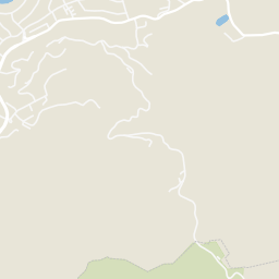
Rings at ½ mile and 1 mile. Basemap © OpenMapTiles © OpenStreetMap contributors.
Open the San Rafael camera map6 license-plate readers mapped within 1 mile of this home, all identified as Flock Safety devices. None within ½ mile. Nearest: 0.8 mi northwest.
| Device type | Within ½ mi | Within 1 mi |
|---|---|---|
| License-plate readers | 0 | 6 |
| of which Flock Safety | 0 | 6 |
Community-reported via OpenStreetMap; may be incomplete. Data as of . © OpenStreetMap contributors (ODbL)
License-plate readers (ALPR) are fixed cameras that photograph passing vehicles and read their plates. Records are typically shared with the agency or association that operates the camera.
Flock Safety is a company whose plate-reader cameras are used by police departments, cities, HOAs and businesses. Its devices are usually solar-powered and pole-mounted.