42

$575,000
4 bd · 2 ba · 2,586 sqft
77 Narragansett Avenue, Westerly, RI
Kassi Mazzucco · Compass


No listing photos
3
Beds
2.5
Baths
1,812
Sqft
1983
Year built
Range $590,939 – $647,061 · as of August 30, 2026
ATTOM automated valuation model · 54 published estimates over 6.7 years
Highest reading $738,208 in March 2026; lowest $356,904 in January 2020. The vertical scale starts at the series' own low, not at zero — it is drawn to show movement, not absolute size.
$123,800
Estimated monthly payment
$4,086/mo
Loan amount $495,200. Estimate only — your actual rate and payment depend on credit, location, and lender.
2025 roll
StateWide MLSSome properties which appear for sale on this web site may subsequently have sold or may no longer be available.
42$575,000
4 bd · 2 ba · 2,586 sqft
77 Narragansett Avenue, Westerly, RI
Kassi Mazzucco · Compass
 New33
$719,000
2 bd · 3 ba · 1,440 sqft
25 Captains Drive, Westerly, RI
The Schilke Team · Schilke Realty
 36
$520,000
4 bd · 2 ba · 1,619 sqft
2 Surrey Drive, Westerly, RI
Lawrence Colli · Williams & Stuart Real Estate
 36
$469,900
2 bd · 1 ba · 984 sqft
8 Wilder Avenue, Westerly, RI
Sandy Bliven · RE/MAX South County
 47
$650,000
3 bd · 2 ba · 1,638 sqft
11 Eddy Drive, Westerly, RI
Kimber Pope Kettlety · Coldwell Banker Coastal Homes
 New16
$479,000
3 bd · 1 ba · 1,503 sqft
100 John Street, Westerly, RI
Michaela Lamb · Sold By Michaela LLC
School ratings (A+ to F) from HJN community data.
Westerly High School
9-12 · Regular · Westerly School District
650 students · 9.6:1 student–teacher
Babcock Hall Inclusionary Preschool
PK-PK · Regular · Westerly School District
87 students · 12.4:1 student–teacher
State Street Elementary School
KG-4 · Regular · Westerly School District
212 students · 9.6:1 student–teacher
St Michael School
PK-8 · Regular
157 students · 13.3:1 student–teacher
Stonington Middle School
6-8 · Regular · Stonington School District
366 students · 8.2:1 student–teacher
West Vine Street Elementary School
KG-5 · Regular · Stonington School District
342 students · 9.5:1 student–teacher
Westerly Middle School
5-8 · Regular · Westerly School District
639 students · 11.0:1 student–teacher
Springbrook Elementary School
KG-4 · Regular · Westerly School District
243 students · 9.3:1 student–teacher
Rings at ½ mile and 1 mile. Basemap © OpenMapTiles © OpenStreetMap contributors.
Open the Westerly camera map1 license-plate reader mapped within 1 mile of this home, identified as a Flock Safety device. None within ½ mile. Nearest: 0.9 mi south.
| Device type | Within ½ mi | Within 1 mi |
|---|---|---|
| License-plate readers | 0 | 1 |
| of which Flock Safety | 0 | 1 |
Community-reported via OpenStreetMap; may be incomplete. Data as of . © OpenStreetMap contributors (ODbL)
License-plate readers (ALPR) are fixed cameras that photograph passing vehicles and read their plates. Records are typically shared with the agency or association that operates the camera.
Flock Safety is a company whose plate-reader cameras are used by police departments, cities, HOAs and businesses. Its devices are usually solar-powered and pole-mounted.
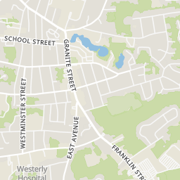
Within 2 miles of this home: 39+ restaurants and cafés, 4 grocery stores, 16 parks and green spaces, and 10 transit stops.
Place data from OpenStreetMap.
Ella's
Tower Street
Kelly's Deli
Orange Leaf
Vetrano's
Domino's
Granite Street
D'Angelo Grilled Sandwiches
Granite Street
Graze Burgers
McDonald's
Granite Street
ALDI
Franklin Street
Mc Quades Marketplace
Main Street
Stop & Shop
Franklin Street
Sandy's Fine Foods
Grow and Go Seek Community Garden
Cimalore Field
Wilson Street
Santo Algiere Conservation Park
Captain Bruce Ladd Memorial Dog Park
Chapman Pond
Craig's Field
Mountain Avenue
Rawson Mateials (Cherenzia Quarry)
Wilcox Park
Grove before Wilcox
Grove and Wilcox
High after Grove
High and Grove
Westerly Town Hall
Westerly Railroad Station
Westerly Train Station
Westerly