32
$309,900
3 bd · 1 ba · 1,869 sqft
60 Worthy Ave, West Springfield, MA
Michael Rodgers · Lock and Key Realty Inc.


No listing photos
3
Beds
1.5
Baths
1,844
Sqft
1960
Year built
Range $356,794 – $377,760 · as of August 30, 2026
ATTOM automated valuation model · 54 published estimates over 6.7 years · shaded band is the model's own published low-to-high range
Highest reading $427,750 in July 2025; lowest $254,813 in April 2020. The vertical scale starts at the series' own low, not at zero — it is drawn to show movement, not absolute size.
$73,455
Estimated monthly payment
$2,488/mo
Loan amount $293,822. Estimate only — your actual rate and payment depend on credit, location, and lender.
2025 roll
School ratings (A+ to F) from HJN community data.
John Ashley Kindergarten School
KG-KG · Regular · West Springfield School District
148 students · 8.4:1 student–teacher
Maurice A. Donahue Elementary School
PK-5 · Regular · Holyoke School District
388 students · 12.1:1 student–teacher
Gen John J Stefanik
KG-5 · Regular · Chicopee School District
392 students · 11.8:1 student–teacher
Holyoke Stem Academy
6-8 · Regular · Holyoke School District
289 students · 15.2:1 student–teacher
Lt. Elmer J. McMahon Elementary School
PK-5 · Regular · Holyoke School District
317 students · 10.6:1 student–teacher
West Springfield Middle School
6-8 · Regular · West Springfield School District
909 students · 11.4:1 student–teacher
Bowe
KG-5 · Regular · Chicopee School District
411 students · 12.4:1 student–teacher
John R. Fausey Elementary School
1-5 · Regular · West Springfield School District
435 students · 11.6:1 student–teacher
Some properties which appear for sale on this web site may subsequently have sold or may no longer be available.
 MLS Property Information Network (MLS PIN)
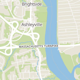
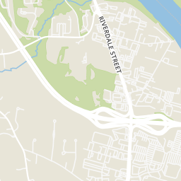
Rings at ½ mile and 1 mile. Basemap © OpenMapTiles © OpenStreetMap contributors.
Open the West Springfield camera map2 CCTV cameras mapped within ½ mile of this home. Nearest: 0.3 mi southeast. Operator named in the data: Massachusetts Department of Transportation.
| Device type | Within ½ mi | Within 1 mi |
|---|---|---|
| License-plate readers | 0 | 2 |
| of which Flock Safety | 0 | 2 |
| CCTV cameras | 2 | 3 |
Community-reported via OpenStreetMap; may be incomplete. Data as of . © OpenStreetMap contributors (ODbL)
License-plate readers (ALPR) are fixed cameras that photograph passing vehicles and read their plates. Records are typically shared with the agency or association that operates the camera.
Flock Safety is a company whose plate-reader cameras are used by police departments, cities, HOAs and businesses. Its devices are usually solar-powered and pole-mounted.
CCTV cameras are fixed video cameras that record a street, building or other area.
Within 2 miles of this home: 21 restaurants and cafés, 16 parks and green spaces, and 29+ transit stops.
Place data from OpenStreetMap.
Dunkin
Riverdale Street
McDonald's
Holyoke Street
Outback Steakhouse
Riverdale Street
Piccadilly Restaurant and Pub
Riverdale Street
Starbucks
Popeyes
Holyoke Street
Red Robin
Dunkin' Donuts
Whiting Farms Road
Connecticut River Access
Connor Reservoir
Bear Hole Watershed
Ingleside Playground
Lost Pond
Spray Park
Ashley Pond
Ashley Cutoff
WHITNEY / MALL DR
HIGHLAND / PROSPECT
WHITNEY / WHITNEY STREET
RIVERDALE / MARION
RIVERDALE / UNKNOWN
Riverdale and Brightside Dr
RIVERDALE / ALTHEA
HOLYOKE MALL PARKING LOT DR. / HOLYOKE