Price Reduced20

$314,700
3 bd · 3 ba · 2,661 sqft
3114 Heritage Heights Way, Jeffersonville, IN
Lisa Thames-Warfield · Keller Williams Collective


No listing photos
3
Beds
2
Baths
1,255
Sqft
1996
Year built
Range $285,978 – $319,018 · as of August 30, 2026
ATTOM automated valuation model · 55 published estimates over 6.7 years · shaded band is the model's own published low-to-high range
Highest reading $349,302 in February 2026; lowest $175,440 in March 2020. The vertical scale starts at the series' own low, not at zero — it is drawn to show movement, not absolute size.
$60,500
Estimated monthly payment
$2,043/mo
Loan amount $241,998. Estimate only — your actual rate and payment depend on credit, location, and lender.
2025 roll
Southern Indiana REALTORS AssociationSome properties which appear for sale on this web site may subsequently have sold or may no longer be available.
Price Reduced20$314,700
3 bd · 3 ba · 2,661 sqft
3114 Heritage Heights Way, Jeffersonville, IN
Lisa Thames-Warfield · Keller Williams Collective
 New58
$284,999
4 bd · 2 ba · 2,150 sqft
88 Forest Drive, Jeffersonville, IN
Kelly Whitaker · GreenTree Real Estate Services
 Price Reduced14
$284,900
4 bd · 2 ba · 1,501 sqft
3502 Noah Trail, Jeffersonville, IN
Marie D Edwards · HMS Real Estate, LLC
 Price Reduced26
$309,900
4 bd · 3 ba · 1,953 sqft
3494 Noah Trail, Jeffersonville, IN
Marie D Edwards · HMS Real Estate, LLC
 16
$270,900
3 bd · 2 ba · 1,149 sqft
1175 - Lot 568 Parkland Trail, Jeffersonville, IN
Lisa Morris · RE/MAX FIRST
 4
$273,900
3 bd · 2 ba · 1,234 sqft
1176 - Lot 544 Parkland Trail, Jeffersonville, IN
Lisa Morris · RE/MAX FIRST
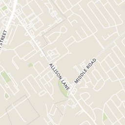
Within 2 miles of this home: 25 restaurants and cafés, 3 grocery stores, 13 parks and green spaces, and 4 transit stops.
Place data from OpenStreetMap.
Hardee's
Allison Lane
Zaxby's
Tumbleweed
Mexican restaurant
Domino's
Meijer Road
Burger King
East 10th Street
Zesto's
McDonald's
East 10th Street
Penn Station
Meijer
Allison Lane
ALDI
Kroger
Jeffersonville Commons Drive
River City Park
Richard L. Vissing Park
Vissing Park Road
Pamela J Inman Park
Robin Lane
Allison Brook Park
Allison Lane
Forest Park
Forest Drive
Kyle Vissing Park
Forest Drive
Shirley's Arbor Park
Connie Sellmer Park
Oakridge Drive
Meijer / Allison Lane
Middle / Alison Lane
10th / Sportman
10th / Sportsman
Rings at ½ mile and 1 mile. Basemap © OpenMapTiles © OpenStreetMap contributors.
Open the Jeffersonville camera map5 license-plate readers mapped within ½ mile of this home, all identified as Flock Safety devices. Nearest: 0.4 mi west.
| Device type | Within ½ mi | Within 1 mi |
|---|---|---|
| License-plate readers | 5 | 13 |
| of which Flock Safety | 5 | 13 |
Community-reported via OpenStreetMap; may be incomplete. Data as of . © OpenStreetMap contributors (ODbL)
License-plate readers (ALPR) are fixed cameras that photograph passing vehicles and read their plates. Records are typically shared with the agency or association that operates the camera.
Flock Safety is a company whose plate-reader cameras are used by police departments, cities, HOAs and businesses. Its devices are usually solar-powered and pole-mounted.
School ratings (A+ to F) from HJN community data.
Jeffersonville High School
9-12 · Regular · Greater Clark County Schools
2,202 students · 18.9:1 student–teacher
Riverside Elementary School
PK-5 · Regular · Greater Clark County Schools
568 students · 15.6:1 student–teacher
W E Wilson Elementary School
PK-5 · Regular · Greater Clark County Schools
518 students · 15.0:1 student–teacher