
 Price Reduced26

$369,999
3 bd · 3 ba · 1,354 sqft
8920 Carter Montgomery Avenue, Las Vegas, NV
Vincent X. Andrade · Summit Real Estate Group

No listing photos
3
Beds
2.5
Baths
1,539
Sqft
2004
Year built
Range $293,726 – $337,776 · as of October 21, 2026
ATTOM automated valuation model · 54 published estimates over 6.8 years · shaded band is the model's own published low-to-high range
Highest reading $405,081 in August 2022; lowest $200,600 in March 2020. The vertical scale starts at the series' own low, not at zero — it is drawn to show movement, not absolute size.
$63,150
Estimated monthly payment
$2,105/mo
Loan amount $252,601. Estimate only — your actual rate and payment depend on credit, location, and lender.
2026 roll
School ratings (A+ to F) from HJN community data.
Sandra L. Thompson Elementary School
KG-5 · Regular · Clark County School District
628 students · 16.1:1 student–teacher
Kenneth Divich Elementary School
KG-5 · Regular · Clark County School District
1,171 students · 18.3:1 student–teacher
Edmundo Escobedo, Sr. Middle School
6-8 · Regular · Clark County School District
918 students · 24.2:1 student–teacher
Somerset Academy Sky Pointe
KG-12 · Regular · State Sponsored Charter Schools
2,172 students · 20.9:1 student–teacher
Imagine School Mountain View
KG-6 · Regular · State Sponsored Charter Schools
695 students · 49.6:1 student–teacher
Henry & Evelyn Bozarth Elementary School
KG-5 · Regular · Clark County School District
723 students · 17.2:1 student–teacher
Coral Academy Centennial Hills
KG-8 · Regular · State Sponsored Charter Schools
686 students · 24.5:1 student–teacher
Marshall C. Darnell Elementary School
KG-5 · Regular · Clark County School District
632 students · 15.8:1 student–teacher
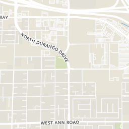
Rings at ½ mile and 1 mile. Basemap © OpenMapTiles © OpenStreetMap contributors.
Open the Las Vegas camera map5 license-plate readers mapped within 1 mile of this home, all identified as Flock Safety devices. None within ½ mile. Nearest: 0.8 mi northeast. Operator named in the data: Lowe's.
| Device type | Within ½ mi | Within 1 mi |
|---|---|---|
| License-plate readers | 0 | 5 |
| of which Flock Safety | 0 | 5 |
Community-reported via OpenStreetMap; may be incomplete. Data as of . © OpenStreetMap contributors (ODbL)
License-plate readers (ALPR) are fixed cameras that photograph passing vehicles and read their plates. Records are typically shared with the agency or association that operates the camera.
Flock Safety is a company whose plate-reader cameras are used by police departments, cities, HOAs and businesses. Its devices are usually solar-powered and pole-mounted.
Las Vegas REALTORSSome properties which appear for sale on this web site may subsequently have sold or may no longer be available.
Price Reduced26$369,999
3 bd · 3 ba · 1,354 sqft
8920 Carter Montgomery Avenue, Las Vegas, NV
Vincent X. Andrade · Summit Real Estate Group
 23
$323,000
3 bd · 3 ba · 1,258 sqft
9164 Acclamation Court, Las Vegas, NV
Lani J. Belcher · eXp Realty
 Price Reduced27
$312,000
2 bd · 3 ba · 1,510 sqft
5404 La Patera Lane, Las Vegas, NV
Rachel Griego · Opendoor Brokerage LLC
 New36
$360,000
3 bd · 2 ba · 1,234 sqft
9260 Spiderlily Court, Las Vegas, NV
Jennifer L. Graff · Simply Vegas
 46
$375,000
3 bd · 3 ba · 1,599 sqft
9029 Garden Fox Court, Las Vegas, NV
Donna Schneider · ERA Brokers Consolidated
 Price Reduced22
$339,900
2 bd · 2 ba · 1,002 sqft
7805 Horsenettle Street, Las Vegas, NV
Stanley J. King · eXp Realty
Within 2 miles of this home: 39+ restaurants and cafés, 3 grocery stores, 20 parks and green spaces, and 40+ transit stops.
Place data from OpenStreetMap.
Ohjah
Japanese restaurant
PT's Gold
Capriotti's
Marco's Pizza
Cereal Killerz
El Norte Taco Shop
Mexican restaurant
Starbucks
North Durango Drive
Arby's
North Durango Drive
Smith's
North Durango Drive
Sprouts Farmers Market
Farm Road
Albertsons
Farm Road
Winding Trails Dog Park
North Fort Apache Road
Winding Trails Park
North Fort Apache Road
Spinnaker Park
Mountain Ridge Park
Pop Squires Park
Fort Apache Detention Basin
Gilcrease Brothers Park
Eagle Canyon Park
Eastbound Farm after Fort Apache
Westbound Farm after Tapestry Park
Eastbound Farm before Oso Blanca
Northbound Oso Blanca before Farm
Southbound Oso Blanca after Farm
Northbound Fort Apache after Farm
Northbound Durango after Oso Blanca
Southbound Durango after Elkhorn