24

$335,000
3 bd · 2 ba · 1,676 sqft
10562 Oakley Trace, Baton Rouge, LA
Kodie Robertson · Blue Porch Properties


No listing photos
—
Beds
—
Baths
4,400
Sqft
1979
Year built
2025 roll
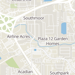
Within 2 miles of this home: 34+ restaurants and cafés, 8 grocery stores, 14 parks and green spaces, and 4 transit stops.
Place data from OpenStreetMap.
Smoothie King
Little Caesars
Starbucks
Airline Highway
Taco Bell
Airline Highway
Chinese Inn
Chinese restaurant · Airline Highway
Cracker Barrel
American restaurant · Plaza Americana Drive
Raising Cane's
Drusilla Seafood Rest
Albertsons
Airline Highway
Walmart Neighborhood Market
Old Hammond Highway
Rouses
Barkemeyer Law Firm - DWI Lawyers
United Plaza Boulevard
Hi Nabor Supermarket
Florida Boulevard
Ideal Market
South Sherwood Forest Boulevard
Our Daily Bread
Florida Boulevard
Whole Foods Market
Drusilla Park
Old Hammond Highway Park
Cedarcrest Park
Old Quarters Pond
Parkview Park
BREC Jefferson Highway Park
Jefferson Highway
Sharp Road Park
Independence Park
Jefferson @ Drusilla Shopping Center
Jefferson @ Drusilla Dr
Coursey Blvd @ Coursey Ct - W
Independence Blvd. @ Department of Motor Vehicles
Corporate Boulevard
Greater Baton Rouge Association of REALTORS Midwest Real Estate Data (MRED)
Some properties which appear for sale on this web site may subsequently have sold or may no longer be available.
24$335,000
3 bd · 2 ba · 1,676 sqft
10562 Oakley Trace, Baton Rouge, LA
Kodie Robertson · Blue Porch Properties
 36
$529,000
2 bd · 3 ba · 3,230 sqft
45 Jamestowne Court, Baton Rouge, LA
Alissa Jenkins · Compass Lafayette · on 2 MLSs
 23
$385,000
3 bd · 2 ba · 1,842 sqft
10550 Tanwood Ave, Baton Rouge, LA
Rachel Creed · Compass - Perkins
 Price Reduced27
$399,900
3 bd · 2 ba · 2,238 sqft
9979 Hackberry Dr, Baton Rouge, LA
Irene Hebert · Compass - Perkins
 21
$389,900
3 bd · 2 ba · 1,943 sqft
10917 Fernbrook Ave, Baton Rouge, LA
Kar Gary · Compass - Perkins
 36
$449,900
3 bd · 3 ba · 2,300 sqft
48 Jamestowne Ct, Baton Rouge, LA
Jill Roby Pike · Compass - Perkins
Rings at ½ mile and 1 mile. Basemap © OpenMapTiles © OpenStreetMap contributors.
Open the Baton Rouge camera map2 license-plate readers mapped within ½ mile of this home, one of them identified as a Flock Safety device. Nearest: 0.1 mi northwest.
| Device type | Within ½ mi | Within 1 mi |
|---|---|---|
| License-plate readers | 2 | 6 |
| of which Flock Safety | 1 | 5 |
Community-reported via OpenStreetMap; may be incomplete. Data as of . © OpenStreetMap contributors (ODbL)
License-plate readers (ALPR) are fixed cameras that photograph passing vehicles and read their plates. Records are typically shared with the agency or association that operates the camera.
Flock Safety is a company whose plate-reader cameras are used by police departments, cities, HOAs and businesses. Its devices are usually solar-powered and pole-mounted.
School ratings (A+ to F) from HJN community data.
Tara High School
9-12 · Regular · East Baton Rouge Parish School District
1,016 students · 14.7:1 student–teacher
Broadmoor Elementary School
PK-5 · Regular · East Baton Rouge Parish School District
579 students · 14.8:1 student–teacher
Broadmoor Senior High School
9-12 · Regular · East Baton Rouge Parish School District
791 students · 15.7:1 student–teacher
Cedarcrest-Southmoor Elementary School
PK-5 · Regular · East Baton Rouge Parish School District
644 students · 17.6:1 student–teacher
St Lillian Academy
4-4 · Special Education
49 students · 5.4:1 student–teacher
Hosanna Christian Academy
PK-8 · Regular
385 students · 13.3:1 student–teacher
St Lukes Episcopal School
PK-8 · Regular
195 students · 6.3:1 student–teacher
LaSalle Elementary School
PK-5 · Regular · East Baton Rouge Parish School District
338 students · 9.6:1 student–teacher