Price Reduced42

$800,000
3 bd · 4 ba · 2,012 sqft
56 Darrow St, Worcester, MA
Noel Nieves · Property Investors & Advisors, LLC


No listing photos
—
Beds
—
Baths
30,516
Sqft
2015
Year built
Range $776,000 – $1,312,000 · as of April 1, 2020
ATTOM automated valuation model · 4 published estimates over 0.2 years · shaded band is the model's own published low-to-high range
Highest reading $1,044,000 in January 2020; lowest $1,044,000 in January 2020. The vertical scale starts at the series' own low, not at zero — it is drawn to show movement, not absolute size.
$208,800
Estimated monthly payment
$6,732/mo
Loan amount $835,200. Estimate only — your actual rate and payment depend on credit, location, and lender.
2026 roll
MLS Property Information Network (MLS PIN)Some properties which appear for sale on this web site may subsequently have sold or may no longer be available.
School ratings (A+ to F) from HJN community data.
Burncoat Middle School
7-8 · Regular · Worcester School District
720 students · 13.6:1 student–teacher
Burncoat Senior High School
9-12 · Regular · Worcester School District
1,073 students · 13.3:1 student–teacher
Abby Kelley Foster Charter Public School
KG-12 · Regular · Abby Kelley Foster Charter Public
1,426 students · 11.3:1 student–teacher
Thorndyke Road
KG-6 · Regular · Worcester School District
319 students · 14.9:1 student–teacher
Worcester Academic Center for Transition (Act)
1-6 · Special Education · Worcester School District
49 students · 3.9:1 student–teacher
Wawecus Road School
KG-6 · Regular · Worcester School District
155 students · 11.6:1 student–teacher
Bancroft School
PK-12 · Regular
395 students · 5.1:1 student–teacher
Forest Grove Middle School
7-8 · Regular · Worcester School District
839 students · 11.4:1 student–teacher
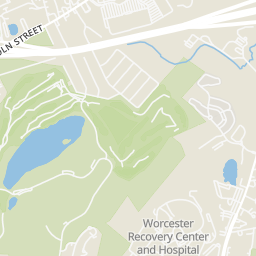
Rings at ½ mile and 1 mile. Basemap © OpenMapTiles © OpenStreetMap contributors.
Open the Worcester camera map1 CCTV camera mapped within ½ mile of this home. Nearest: 0.4 mi southwest. Operator named in the data: Massachusetts Department of Transportation.
| Device type | Within ½ mi | Within 1 mi |
|---|---|---|
| CCTV cameras | 1 | 3 |
Community-reported via OpenStreetMap; may be incomplete. Data as of . © OpenStreetMap contributors (ODbL)
CCTV cameras are fixed video cameras that record a street, building or other area.
Within 2 miles of this home: 37+ restaurants and cafés, 5 grocery stores, 31 parks and green spaces, and 7 transit stops.
Place data from OpenStreetMap.
Ready Set Pizza
Panera Bread
Gold Star Boulevard
Honey Dew
Dunkin
West Boylston Street
Chick-fil-A
Gold Star Boulevard
Subway
West Boylston Street
Fatima's Cafe
West Boylston Street
Min's Wok
Price Rite
Shaw's
West Boylston Street
ALDI
Lincoln Street
Price Chopper
Pullman Street
Stop & Shop
West Boylston Street
Dodge Park
Frostholm Park
Indian Lake Park
Burncoat Park Ext
Indian Lake
Burncoat Park
Wawecus Pond
Kendrick Field
RT 30+31
RT 30+31- Greendale Mall
8/30/31 Grove St/Chadwick St
8/30/31 Gold Star Blvd/Chadwick St
30
Target Lincoln Plaza
30 The Trolley Stop