Price Reduced69

$675,000
4 bd · 4 ba · 3,588 sqft
5572 Highway 76, E, Springfield, TN
Desmond Wright · Maverick Realty

$319/sqft · 122 days on Realty
2,040
Building
0.59 acres
Lot
1992
Built
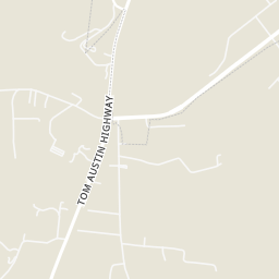
Formerly known as Sherry's Florist & Gift Shoppe for 39 years, this iconic commercial building is a recognizable landmark in Springfield. Rich with history and community charm, the property offers endless possibilities for a variety of small businesses, including retail, boutique, office space, salon, café, or specialty shop. Positioned in a well-established location just off Tom Austin Hwy, this building is ready for its next chapter. Whether you're launching a new venture or expanding your existing business, this is a rare opportunity to own a property with a trusted reputation and strong local recognition. Bring your vision and make this beloved Springfield building the home of your business!
Listing agent
Ed Cope
Courtesy of Cope Associates Realty & Auction, LLC
(615) 533-9234
Realtracs · Listing RTC3250971
2025 roll
RealtracsThis content last refreshed on 2026-10-26 11:49:02 UTC. Some properties which appear for sale on this web site may subsequently have sold or may no longer be available.
Price Reduced69$675,000
4 bd · 4 ba · 3,588 sqft
5572 Highway 76, E, Springfield, TN
Desmond Wright · Maverick Realty
 47
$600,000
3 bd · 3 ba · 2,430 sqft
7921 New Chapel Rd, Springfield, TN
Gary Ashton · The Ashton Real Estate Group of RE/MAX Advantage
 Price Reduced49
$695,000
3 bd · 3 ba · 2,776 sqft
312 Cayce Dr, Springfield, TN
Lisa Zorich · eXp Realty
 23
$650,000
3 bd · 3 ba · 2,300 sqft
2731 Cave Springs Rd, Springfield, TN
Nakeisha Tate · Thrive Realty, LLC
 56
$649,900
3 bd · 2 ba · 2,038 sqft
8157 Highway 49, E, Springfield, TN
Barry Richards · EXIT Prime Realty
 Price Reduced24
$529,900
3 bd · 2 ba · 2,026 sqft
2094 Beverly Ct, Springfield, TN
Lydia Kim · Cope Associates Realty & Auction, LLC
Within 2 miles of this home: 17 restaurants and cafés, 4 grocery stores, 4 parks and green spaces, and 2 transit stops.
Place data from OpenStreetMap.
Sonic
Tom Austin Highway
Subway
Tom Austin Highway
McDonald's
Memorial Boulevard
Taco Bell
Tom Austin Highway
El Molcajete (Elmo's)
Mexican restaurant · Kirby Street
Arby's
J I Baldwin & Son Pit Barbecue
Central Avenue East
Larry's Restaurant
Central Avenue East
ALDI
Tom Austin Highway
Walmart Supercenter
Tom Austin Highway
Kroger
Memorial Boulevard
H.G. Hill Food Stores
Memorial Boulevard
Martin Luther King Jr. Park
Wartrace Lake
Garner St. Park
Central Bark
SPRINGFIELD WAL MART P & R
SPRINGFIELD D/T P & R
Rings at ½ mile and 1 mile. Basemap © OpenMapTiles © OpenStreetMap contributors.
Open the Springfield camera map1 license-plate reader mapped within ½ mile of this home, identified as a Flock Safety device. Nearest: 0.3 mi west. Operator named in the data: Lowe's.
| Device type | Within ½ mi | Within 1 mi |
|---|---|---|
| License-plate readers | 1 | 3 |
| of which Flock Safety | 1 | 3 |
Community-reported via OpenStreetMap; may be incomplete. Data as of . © OpenStreetMap contributors (ODbL)
License-plate readers (ALPR) are fixed cameras that photograph passing vehicles and read their plates. Records are typically shared with the agency or association that operates the camera.
Flock Safety is a company whose plate-reader cameras are used by police departments, cities, HOAs and businesses. Its devices are usually solar-powered and pole-mounted.